India needs a Bhu Nyaya Sanhita, not just faster land courts
India’s land disputes suffer from more than judicial delay. The deeper problem is fragmentation: records, maps, title and possession are handled by different institutions and often through disconnected processes. A purpose-built Bhu Nyaya Sanhita could bring them together, making land justice faster, simpler and, crucially, complete
India’s land disputes do not merely take too long. They are processed through a system that misreads how land conflicts arise. A land dispute seldom turns on abstract legal right alone. It rests on three connected elements: the record, the map and possession. The record says who claims the right. The map says where that right lies. Possession shows who occupies or uses the land. Justice is complete only when all three converge, yet India’s institutions pull them apart. Revenue authorities keep records, survey departments handle maps, registration offices log instruments, and civil courts decide proprietary rights. A citizen may win in one forum and still need a second to correct the record, a third to alter the map and a fourth to obtain possession. The problem is not delay alone. It is fragmentation.
The Code of Civil Procedure, 1908 remains the basic framework for land litigation. It can be amended further, but land disputes are distinctive enough to justify something bolder: a purpose-built Bhu Nyaya Sanhita, or Land Justice Code. Indian law already accepts differentiated procedure: commercial disputes run on stricter timelines, insolvency operates against a statutory clock, and RERA created its own adjudicatory framework. Its objective should be simple: every final decision must bring record, map and possession into convergence.
Classify before adjudicating
The first departure should be classification at entry. Today, similar controversies surface as suits for declaration, injunction, cancellation, partition, correction of records or recovery of possession, and jurisdiction often turns on how relief is drafted rather than on the real conflict. The Code could instead catalogue land disputes, much as a penal code classifies offences by defined ingredients, without criminalising civil disagreement.
Record disputes would cover fraudulent mutation, contested succession entries, duplicate records, and mismatches between registration data and the Record of Rights. Map and boundary disputes would cover overlapping parcels, shifted boundaries, survey errors, excess or deficient area, and gaps between textual records and cadastral maps. A map left unrevised after inheritance, partition or acquisition could count as an incomplete spatial mutation. Possession disputes would include dispossession, encroachment, tenancy, permissive and co-sharer possession, and adverse possession. Title and transaction disputes would take in competing conveyances, wills, family settlements, cancellation of instruments, fraud and impersonation. Public-law disputes over acquisition, ceiling, consolidation, government grants, common lands and public encroachment would form another.
For each category, the Code could specify essential assertions, permissible defences, standard documents, presumptions, limitation, interim relief, forum, appellate route and post-judgment action. A boundary dispute need not follow the evidentiary path of a fraudulent conveyance. A mutation controversy need not become a title suit. And a serious proprietary dispute should not be settled merely because one party holds a favourable revenue entry.
The law can therefore separate foundational right, current record and judicial determination of title. A right originates in grant, inheritance, partition or transfer; the record reflects recognised later changes; judicial determination is needed when rival claims cannot otherwise be reconciled. Neither an old deed nor a recent mutation is infallible. Courts should apply a best-claim principle, weighing lawful origin, continuity of transactions, parcel identity, consistency of records, possession, notice, good faith and fraud. This would not displace substantive property law; it would structure how courts weigh competing documentary, record-based and possessory claims.
One jurisdictional map
Classification would then fix jurisdiction. Undisputed succession, mutation, clerical correction and consequential map updates would stay administrative. Contested record, survey, boundary, tenancy, consolidation and ceiling matters would go to specialised revenue forums able to commission neutral surveys and grant limited interim protection. Title, cancellation of instruments, complex inheritance, partition, fraud, specific performance and adverse possession would remain with designated civil land courts.
Mixed cases need a dominant-issue test. If a record dispute cannot be resolved without deciding title, the civil land court decides it. If title is admitted and only its implementation is contested, the revenue forum acts. A litigant should not lose years by approaching the wrong forum. Such cases should be transferred, not returned for refiling, with limitation protected and the proceeding continuing from the stage reached.
Appeals need simplifying. A consolidated first appellate mechanism for civil and revenue land disputes would stop parallel hierarchies reaching inconsistent conclusions on the same parcel. High Court scrutiny would remain for substantial questions of law, jurisdictional error and constitutional review. Civil courts would be reserved for disputes that need them, and technical record and survey matters would stop becoming endless civil trials.
From principle to procedure
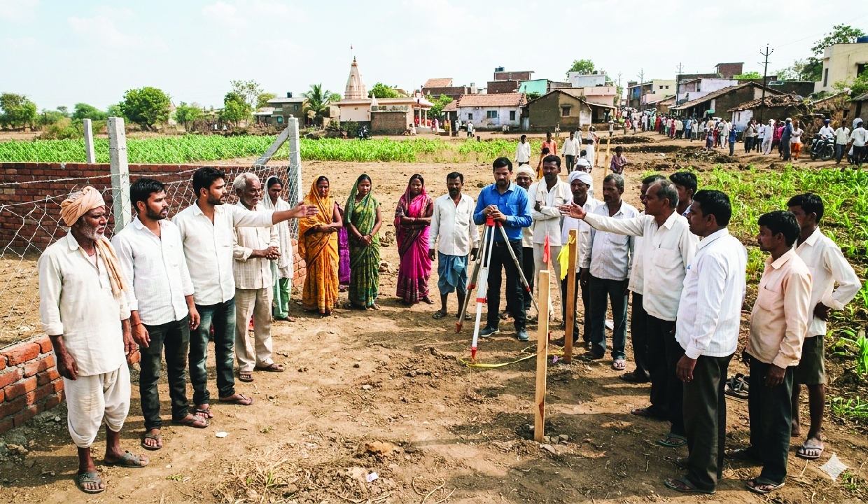
Every proceeding would begin by identifying the parcel. A standard parcel statement would set out the land, source of right, present record, map, registration and mutation history, possession and rival claims. Where digital systems permit, an authenticated parcel dossier could be drawn straight from registration, survey and revenue databases. Defendants would answer the same structured questions rather than offer a general denial. An early case-management hearing would classify the dispute, identify admitted facts, decide whether technical investigation is needed and fix the calendar. Where measurement is disputed, a neutral survey would follow prescribed geospatial standards and produce verifiable coordinates and field proceedings. Oral evidence would remain where intention, fraud, consent or conduct matters. But technical facts should be proved technically: boundaries through authenticated maps and measurement, registration history through official records, physical change through geospatial or time-stamped material. The Code could cap adjournments, interlocutory challenges and extensions, subject to narrow recorded exceptions, and set a statutory outer limit for first-instance disposal, with extra time for complex cases. No procedural stage should stay indefinitely renewable.
Make the decree complete
Execution should not begin as though a second case has started. A land decree should specify who must update the Record of Rights, alter the map, cancel an instrument, remove an encroachment and deliver possession, and it should reach every such authority electronically. Each litigated parcel could carry a common digital case identifier and a lis pendens flag across registration, revenue, court and survey systems. A decree that declares ownership but leaves the winner to fight separately for record, map and possession is justice only on paper. The real test is whether a judgment becomes visible at once in the record, on the map and on the ground.
A federal architecture
Land and land revenue are primarily State subjects, while civil procedure and evidence engage the Concurrent List. A Bhu Nyaya Sanhita must therefore rest on cooperative federalism: a common procedural and evidentiary architecture, with State schedules reflecting local land laws, tenures and institutions. Uniformity need not mean one land law for India, only a coherent way of resolving land disputes.
India has spent decades improving land records, surveys and registration. That information cannot deliver full value while adjudication stays fragmented among institutions that do not communicate. The country needs more than faster land suits. It needs a system where the parcel is identified at entry, the dispute is classified correctly, jurisdiction is known in advance, evidence fits the controversy, timelines carry consequences, and the final order travels automatically into the record, the map and possession. A Bhu Nyaya Sanhita would be more than procedural reform. It would finish the unfinished task of making land records, land rights and land justice speak the same language.
Every land proceeding could begin by identifying the parcel. A standard parcel statement could specify the land, source of right, present record, map, registration and mutation history, possession and known rival claims. Where digital systems permit, an authenticated parcel dossier can be drawn directly from registration, survey and revenue databases
The writer is an ex-IAS officer and is presently Chairman, RERA Bihar. He served as Principal Secretary, Department of Revenue and Land Reforms, Bihar. This is the last part of a three-part series on land reforms; Views presented are personal.