United Rivers of India
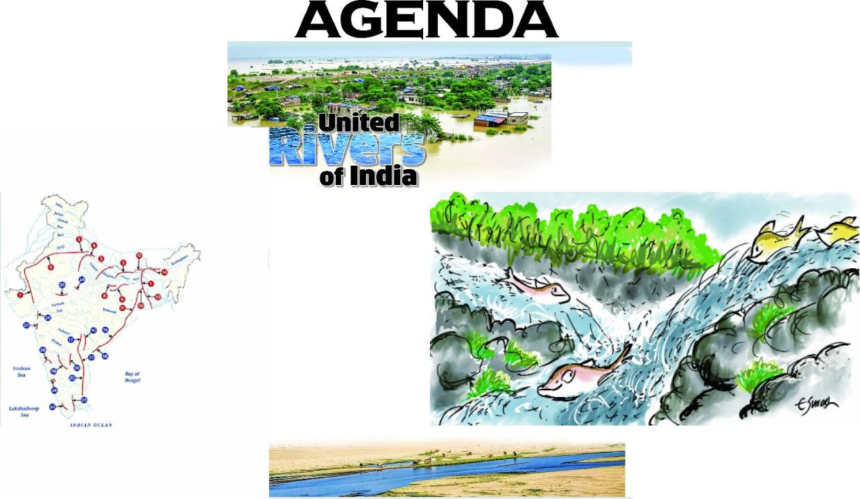
River interlinking project promises multiple benefits: improved irrigation, drinking water supplies, hydropower generation and better flood and drought management. But the challenges are equally formidable. River systems are ecologically interconnected, and diverting water can disrupt ecosystems, forests and fisheries. Large projects may also lead to displacement of communities
The proposition may appear straightforward, link India’s great rivers, from the Brahmaputra in the northeast to the Godavari and Cauvery in the south, and India could potentially overcome water shortages for decades. Union Home Minister Amit Shah recently brought the idea back into public discussion when, at the 31st meeting of the Southern Zonal Council in Mahabalipuram, Tamil Nadu, on August 20, he said that interconnecting India’s great rivers from the Brahmaputra to the Cauvery and Godavari could help ensure that the country faces no water shortage for the next 100 years.
But before we look at the vision as a solution, there is a simpler question. What exactly would it mean to link the Brahmaputra to rivers such as the Godavari and Cauvery?
India has had a formal National Perspective Plan (NPP) for interlinking rivers since 1980. It envisages 30 links, 14 under the Himalayan component and 16 under the Peninsular component. The government says feasibility studies have been completed for many of these links, while Ken-Betwa is the first to enter implementation. There is also a proposal to transfer water from the Godavari towards the Krishna, Pennar and ultimately Cauvery basins.
The Union Home Minister’s proposition therefore does not emerge from nowhere. It sits within a much older national ambition to move water between river basins. But it is important not to confuse that ambition with a ready-to-build Brahmaputra-Godavari-Cauvery project. Such a project would require a defined route, diversion points, storage, volumes, costs, environmental assessments, operating rules and agreements among affected states. That gap between political vision and executable project matters.
At its simplest, river interlinking means transferring water from one basin to another through dams, barrages, reservoirs, canals, tunnels and, where necessary, pumping systems. The underlying argument is that some basins have more water than they need while others face shortages.
The difficulty begins with the word surplus. In the Brahmaputra basin, about 85 per cent of annual rainfall occurs during the monsoon, producing enormous seasonal variations in flow. But high monsoon flow does not automatically mean surplus water. Floodwaters can be destructive, yet the flood pulse also recharges wetlands and groundwater, supports fisheries, spreads nutrients and sediment, and sustains floodplain ecosystems and livelihoods. The Brahmaputra is one of the world’s great sediment-carrying rivers, and its sediment contributes to the maintenance of downstream floodplains and deltaic systems.
The relevant question, therefore, is not how much water a river carries in a wet month, but how much dependable water is actually available for transfer after accounting for existing uses, downstream requirements, ecological needs, seasonal variability and international obligations.
This becomes particularly important when the proposed destination is the peninsular rivers. The Godavari, and Cauvery also receive a substantial share of their annual rainfall and runoff during the monsoon. So what exactly would be transferred from the Brahmaputra?
If the proposal is to move water during the monsoon, the case for transferring water from one river experiencing its principal period of abundance to another doing the same is not immediately obvious. If the intention is instead to capture Brahmaputra flows, store them and transfer them south for use during dry months, the proposition becomes a vast storage-and-transfer system designed to overcome seasonal variability.
That raises another set of questions. Where would the water be stored, how much storage would be required, how much would be lost through evaporation, what energy would be required to move it, and how would the system perform after a weak monsoon? Surplus is not a permanent characteristic of a river basin. It is relative to season, location, demand and hydrological conditions.
The Brahmaputra adds another layer of complexity because it is not simply a large Indian river. It is a transboundary river system originating in Tibet, China and flowing through India and Bangladesh, where it continues as the Jamuna. The basin extends across four countries, with tributaries originating in Bhutan as well. Bangladesh is therefore not an incidental observer of what happens to the river upstream.
India already shares hydrological information with Bangladesh for flood forecasting and disaster preparedness, but there is no comprehensive Brahmaputra water-sharing treaty comparable to the Ganga agreement. A major alteration in the volume or timing of Brahmaputra flows would therefore have implications beyond India’s internal water policy.
India must also consider that it is itself downstream of China in the Brahmaputra system. A major intervention would consequently sit within a wider geopolitical context involving China, India and Bangladesh.
There is another question worth asking. India is already considering moving water southward without reaching for the Brahmaputra. The NPP includes the proposed Godavari-Cauvery link project, which is designed as a three-link system comprising Godavari Inchampalli or Janampet to Krishna Nagarjunasagar, Krishna Nagarjunasagar to Pennar Somasila, and Pennar Somasila to Cauvery Grand Anicut.
If the Godavari-Cauvery connection is already envisaged, why is the Brahmaputra required? Has projected demand in the south grown beyond what the peninsular links can address? Is the available water in the Godavari insufficient? Or are we progressively expanding the geographical area from which water must be sourced because demand itself continues to grow?
These are not merely engineering questions. They concern how India defines its water problem. The northeast and eastern India are often portrayed as having too much water, while western and southern India have too little. There is some truth in this broad seasonal picture, but it can obscure a second reality. India’s water stress is also a problem of management and demand. Groundwater depletion, water-intensive cropping, inefficient irrigation, urban leakage, inadequate used-water reuse, destruction of tanks and wetlands, floodplain encroachment and poor watershed management all contribute to scarcity. This does not mean inter-basin transfers can never form part of India’s water-security strategy. But before moving water across enormous distances, India should establish how much of the projected deficit remains after addressing these factors. The larger the intervention, the stronger that evidence should be.
That leads to a more fundamental question. Is river interlinking being pursued because it is demonstrably the most appropriate response to water stress, or because it sustains a particular model of large-scale construction? There is nothing inherently wrong with infrastructure. India needs water-supply systems, irrigation infrastructure, wastewater-treatment systems and flood-management infrastructure. But infrastructure should follow a clearly demonstrated problem, it should not define the problem in a way that makes increasingly large infrastructure appear necessary.
Feasibility, therefore, cannot be reduced to whether engineers can build the system. A project may be technically possible but economically prohibitive, economically possible but environmentally damaging, politically agreed upon but difficult to govern, or functional under historical hydrological conditions but unreliable under climate change. A system that works in an average year may fail precisely when water is most needed.
The engineering challenge of creating a Brahmaputra-to-peninsular river system would be formidable, involving the diversion, storage and long-distance transfer of water across multiple river basins, potentially requiring extensive pumping. It would also have to contend with sedimentation, evaporation, floods, seismic risks and increasingly variable rainfall patterns. But the federal challenge may be equally important. Who decides how much water moves, when it moves, who gets priority during water scarcity, and what happens when the source state’s own requirements increase? The government itself recognises the importance of agreement among concerned states for interlinking projects.
Ken-Betwa offers an early opportunity to examine these trade-offs. It is the first NPP project to enter implementation, with the government projecting irrigation, drinking-water and hydropower benefits at an approved cost of Rs 44,605 crore. At the same time, it has generated significant environmental concerns, including forest diversion and impacts on the Panna landscape. The lesson is not that large projects are necessarily unacceptable, but that their benefits and costs must be examined together.
International experience offers comparisons but no ready-made blueprint. China’s South-to-North Water Diversion Project, Australia’s Snowy Mountains Scheme, the Lesotho Highlands Water Project and California’s State Water Project demonstrate that very large-scale inter-basin water transfer systems can operate.
They also highlight the enormous investments, institutional capacity, long-term operational arrangements, and significant environmental and social trade-offs required to develop and sustain such large-scale inter-basin water transfer systems.
There is no close global equivalent to what Brahmaputra to Cauvery and Godavari implies. A system potentially connecting a huge transboundary Himalayan River with distant peninsular basins across a federal country. The absence of such a precedent does not, by itself, settle the question of whether such a system can be developed. It does, however, mean that India would be attempting something for which there is no established global blueprint to simply replicate.
Climate change makes the question more urgent. Historical rainfall and river-flow patterns may no longer provide a reliable guide to future conditions. Changing monsoon intensity and timing, extreme rainfall, prolonged dry spells and other hydrological shifts could alter the reliability of projected surpluses.
Before the Brahmaputra is declared a source of national water security, India should therefore publicly demonstrate the calculations. What is the dependable surplus? How much is required downstream? What storage is required? What are the energy and financial costs? How will the system perform during water scarcity? What alternatives have been examined? Which states will be affected? And what are the implications for Bangladesh?
Most importantly, the public should be able to see and scrutinise these calculations. Ultimately, the question is not whether India should ever move water between river basins. Water already moves between basins through natural hydrological connections. The more important questions are whether a proposed transfer is necessary, how much water can actually be transferred without compromising existing downstream needs, and what its ecological, social, economic and political consequences would be. Any such proposal must also be judged against the enormous investments, institutional capacity, long-term operational arrangements, and environmental and social trade-offs that large-scale inter-basin water transfers entail.
The Brahmaputra makes this debate especially consequential. It is a river, a floodplain, a sediment conveyor and the basis of millions of livelihoods, with its waters continuing downstream as the Jamuna.
So when India hears the phrase Brahmaputra to Cauvery and Godavari, the first response should be to ask what exactly is being proposed, what problem it is intended to solve, and whether its hydrological, ecological, social, economic and institutional implications have been adequately examined. That means asking some very basic questions. How much water? From where? In which months? What qualifies as surplus, and according to whose calculations? Where would it be stored? How would it be transferred? At what cost? Who would benefit? Who would bear the risks? And what happens when the river does not behave as planners expect?
India needs water security. But before India attempts to connect its great rivers, it must first demonstrate that the water can, needs to and should be moved.
A proposition is not yet a project. A flood is not necessarily a surplus. And a river is not a pipeline.
The Brahmaputra adds another layer of complexity because it is not simply a large Indian river. It is a transboundary river system
Mapping India’s River Linking Projects
The National Perspective Plan envisages interlinking of 30 rivers through 14 Himalayan and 16 Peninsular projects to transfer surplus water to water-deficit regions and promote equitable water distribution.
HIMALAYAN RIVER LINKING SYSTEM
1. Manas-Sankosh-Tista-Canga
2. Kosi-Chagra
3. Gandak-Ganga
4. Chagra-Yamuna
5. Sarda-Yamuna
6. Yamuna-Rajasthan
7. Rajasthan-Sabarmati
8. Chunar-Gold Barrage
9. One dam-southern tributaries of Ganga
10. Ganga-Damodar-Subarnarekha
11. Subarnarekha-Mahanadi
12. Kosi-Mecchi
13. Farakka-Sunderbans
14. Jogighope-Tista-Farakka
PENINSULAR RIVER LINKING SYSTEM
15. Mahanadi (Manibhadra)-Godavari (Dowlaiswaram)
16. Godavari Inchampalli-Krishna (Pulichintala)
17. Godavari (Inchampalli)-Krishna (Nagarjunasagar)
18. Godavari (Polavaram)-Krishna (Vijaya
19. Krishna (Almatti)-Pens
20. Krishna Srisailam-Pennar
21. Krishna (Nagarjunasagar)-Pennar (Somasila)
22. Pennar (Somasila)-Cauvery (Grand Anicut)
23. Cauvery (Kattalai) Vaigai-Gundar
24. Ken-Betwa
25. Parbati-Kalisindh-Chambal
26. Par-Tapi Narmada
27. Damanganga-Pinjal
28. Bedti-Vanda
29. Netravati-Hemavati
30. Pamba-Achankovil-Valppar
Source: National Perspective Plan for Interlinking of Rivers, 1980
Ken-Betwa Link project
The mega-infrastructure project aims to transfer surplus water from the Ken River in Madhya Pradesh to the water-deficit Betwa River in Uttar Pradesh
States: Madhya Pradesh and Uttar Pradesh.
Current status: Under implementation.
Target completion: 2030, generally stated in government documents as March 2030.
Estimated cost: Rs 44,605 crore.
Planned benefits: Irrigation, drinking-water supply and hydropower generation in parts of Madhya Pradesh and Uttar Pradesh
This is currently the only National Perspective Plan river-linking project for which the Union government has publicly stated a firm completion target.
India’s river-interlinking programme: The journey so far...
India’s river-interlinking programme has 30 proposed links. Its implementation depends on State consent, land acquisition, rehabilitation, environmental and wildlife clearances, and water-sharing agreements; only the Ken-Betwa Link Project is under implementation with a stated completion target of March 2030.
1972 The idea of transferring water between river basins was formally examined through national-level water-resource planning.
1980 The Union government formulated the National Perspective Plan (NPP) for inter-basin water transfer, covering Himalayan and Peninsular River links.
1982 The National Water Development Agency (NWDA) was established to study and develop the proposed links. is an autonomous society established in July 1982 under the Ministry of Jal Shakti, Government of India
1980s-2000s NWDA prepared Pre-Feasibility Reports and Feasibility Reports for proposed links. The programme expanded to 30 identified projects: 16 Peninsular and 14 Himalayan.
2002 The Supreme Court directed the government to pursue the interlinking programme and established monitoring arrangements.
2012 The Supreme Court reiterated the need for a time-bound mechanism and institutional structure to examine the projects.
2014 The government constituted the Special Committee on Inter-Linking of Rivers.
2015 A Task Force for Inter-Linking of Rivers was constituted to help accelerate studies, consultations and implementation.
2021 Uttar Pradesh and Madhya Pradesh signed an agreement for the Ken-Betwa Link Project.
December 2021, the Union Cabinet approved implementation of Ken-Betwa at an estimated cost of Rs 44,605 crore, including Rs 39,317 crore in central support.
2022 Works on Ken-Betwa, including preparatory works and the Daudhan Dam component, started progressively.
2026 Feasibility Reports completed for 26 of 30 links and Detailed Project Reports for 13 links. Ken-Betwa remained the only priority link in the implementation stage. The primary objective is to tackle chronic water scarcity and mitigate droughts in the socio-economically marginalised Bundelkhand region, which spans across both states. The work on Ken-Betwa is likely to be completed by 2030.
The writer is Managing Trustee, Megh Pyne Abhiyan; Views presented are personal.
Leave a Comment
Comments (1)
why can't the journalists draw simple map to explain what they want to? a picture is worth thousands of words. don't they know it?