How Agri stack can catalyse reforms in land revenue administration
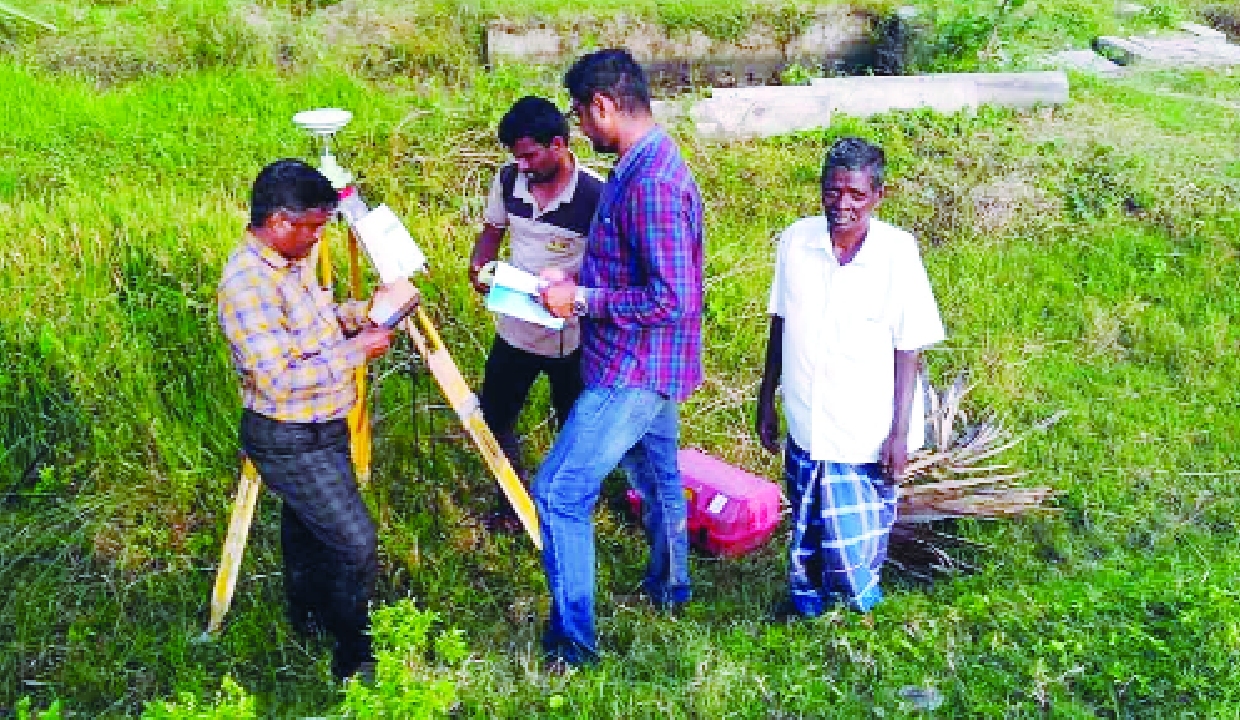
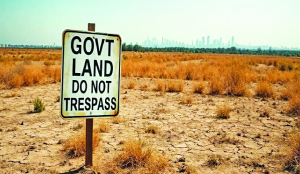
There have been concerted efforts to modernise land-record administration in the country, which are delivering positive outcomes. However, there are still several challenges. States with robust, updated records are at various stages of digitalisation. In many other states, land ownership is still recorded in the names of ancestors. In major parts of the North-Eastern states, there is an absence of conventional records of rights due to the practice of community ownership. Even though there is a widespread practice of sharecropping and informal leasing across the country, there is reluctance to record the same in many states due to the legacy of laws related to adverse possession. National Crime Records Bureau data also indicate that land-related disputes are one of the major motives for crimes in rural areas. The Digital Public Infrastructure (DPI) in agriculture offers a way forward to meet these challenges. To transform governance and policy implementation in the agriculture sector, the Union Government launched the Digital Agriculture Mission (DAM) in 2024. One of the key components of the mission is to establish a DPI for agriculture. The building block of this infrastructure is Agri Stack, comprising three core registries - farm, farmer, and crop sown. Farm Registry is a database of geo-referenced plots with a unique Farm ID. Each agricultural plot is provided with a unique Farm ID for identification. Simultaneously, each farmer owning agricultural land is provided with a unique Farmer ID, which, at the back end, will have complete details of each plot owned by the farmer, along with the share/extent of the farmer in that plot. The Farmer Registry is dynamically linked to the digitised records of rights of the State Revenue Department, ensuring that changes in the records of rights due to sale, inheritance, etc., are automatically updated in the Farmer Registry. The third pillar is the Crop Sown Registry, with details of crops sown on each plot for each crop cycle, developed on the basis of the Digital Crop Survey. The survey is undertaken immediately after the sowing seasons. Discipline in the survey is ensured as it is mandatory for the surveyor to physically enter the plot of land being surveyed to record the crop sown.
Agri Stack is being developed as a collaborative exercise between the Central Government and the State/UT Governments while ensuring that it is credible, standardised, and interoperable across the country, both at the federal and state levels.
As of May 15, 2026, more than 9.50 crore Farmer IDs had been created across the country. The Digital Crop Survey was conducted in more than 30 crore plots across 648 districts, covering 24 states, during the Rabi season of 2025-26.
Agri Stack is being developed primarily to empower farmers to seamlessly avail themselves of various scheme benefits, and not as an alternative to land records or certificates of land ownership and crops sown. The dynamic linkage with records of rights ensures the authenticity of the Farmer Registry. This arrangement of a separate registry linked to records of rights would ensure that farmers are less hesitant in digitally authorising, in the Farmer Registry, their relatives, sharecroppers, and leaseholders (formal or informal) to avail themselves of scheme benefits such as MSP procurement, procurement of fertiliser, crop insurance, or even crop loans.
The flexible architecture of Agri Stack and its potential to be used for availing entitlement-based benefits have catalysed reforms in land-revenue administration and the process of modernisation and digitalisation of land-record administration in several states and Union Territories. One immediate outcome is that the geo-referencing of revenue cadastral maps is being completed within a highly compressed timeframe. Wherever cadastral maps are not available, the state machinery is approaching village elders and searching through record rooms to obtain copies of the maps. Some states have even undertaken survey operations to prepare cadastral maps afresh. State and UT administrations have also moved quickly in recording the share of landholders in plots that have multiple owners, without the necessity of filing a partition suit. The traditional manually driven girdavari or partaal system was prone to errors, with delayed consolidated results, and therefore had limited utility for policymakers. The Digital Crop Survey under Agri Stack is steadily replacing this manual system and becoming a single source of truth, ensuring credibility through the timely and accurate capture of crops sown. Feedback from farmers and the appeal system ensure transparency, with greater involvement of farmers in the process. With Farmer ID becoming a prerequisite for availing various scheme benefits in states, additional pressure is being placed on lower-level officials in the land-revenue administration to record inheritance immediately after the death of a landholding farmer. In states such as Bihar, Jharkhand, Odisha, and Assam, land is often still recorded in the names of ancestors. To address this, current owners can obtain land inheritance certificates, enabling Farmer ID generation while land records are updated. This is helping revenue authorities record actual owners and cultivators, improving access to credit and welfare benefits. The Farmer Registry has also accelerated land-records updation in several states.
In several states in the North-Eastern region of the country where there is community ownership, the absence of surveys to establish individual ownership has led to the sub-optimal uptake of agricultural welfare schemes such as subsidised agricultural credit and crop insurance. The mission has initiated the process of a digitised solution utilising satellite-based imagery to identify existing plot boundaries and develop geo-referenced maps without the need for manual survey operations. Local authorities identify the actual cultivator of each plot and assign unique plot numbers. Farmer IDs are then generated and the Digital Crop Survey undertaken based on the maps so developed. These are not substitutes for land records but a credible alternative for recording the owner/cultivator for availing entitlement-based scheme benefits. Agri Stack has the potential to ensure a regime that protects agricultural land owned by farmers against fraudulent sales and transactions. If the states so desire, they can notify services related to the linkage of landholdings with Aadhaar numbers in the records of rights by notifying the same under Section 4(4)(b)(ii) of the Good Governance Rules under the Aadhaar Act. This notification enables the embedding of the Aadhaar number of the owner in the land owned, with the voluntary consent of the farmer. Thereafter, any fraudulent transaction in the Sub-Registrar’s office becomes detectable and preventable, as it can be carried out only after the recorded tenure-holder has been biometrically verified during the registration of any sale deed or will. This reform has the potential to drastically reduce land disputes and crimes related to land.
The DPI is enabling transformational reforms in welfare delivery and land-record administration, empowering farmers and strengthening the security of their landholdings.
The writer is a former Union Agriculture Secretary; Views presented are personal.