Indonesia steps up Aerial firefighting as blazes scorch forests
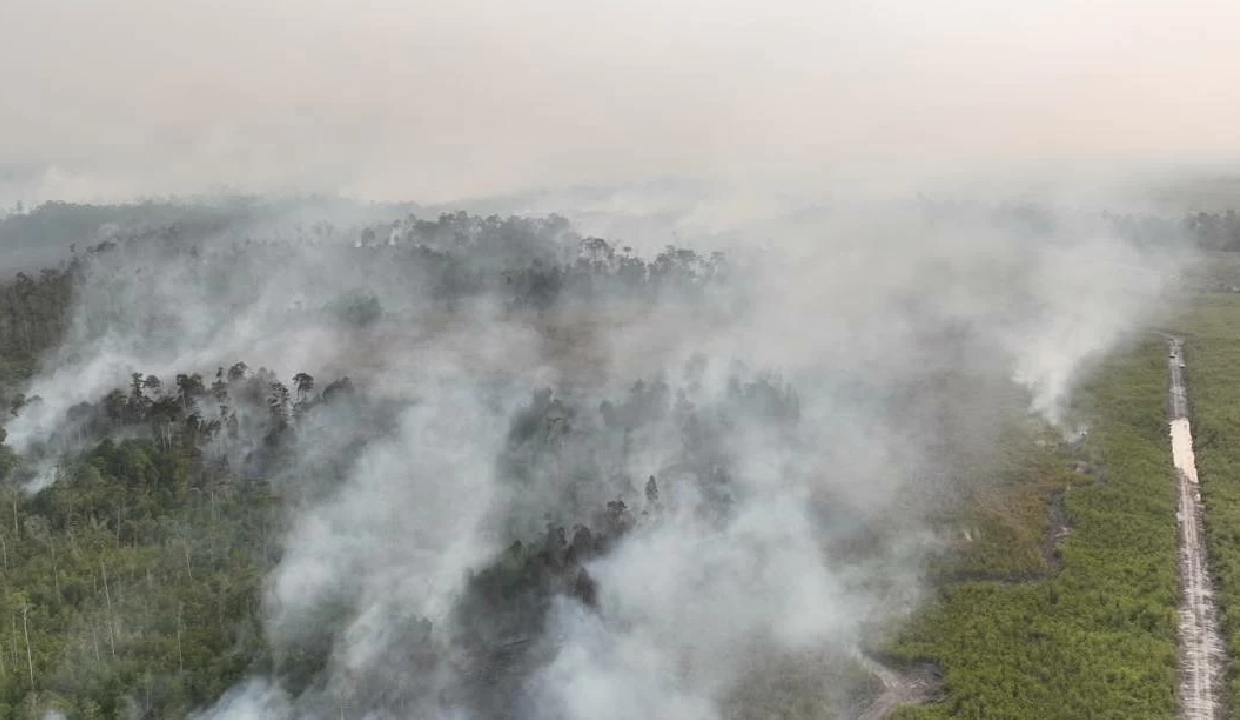
Indonesia on Monday, August 24, ramped up ground and aerial firefighting operations as massive blazes across the central and western parts of the country scorched thousands of hectares of forests and peatland, sending a choking haze over cities and across international borders.
The fires, driven by an intensifying El Nino pattern and a prolonged dry season, have generated dense smoke that has drifted into Malaysia and Brunei, according to Indonesia's National Disaster Management Agency (BNPB).
The agency said Monday, August 24, that fires remain active in several regions, with large-scale suppression efforts continuing in fire-prone provinces including West, Central and South Kalimantan on Borneo Island, and Riau, South Sumatra and Jambi on Sumatra Island. The blazes are part of a broader surge in wildfire activity across the country this year, according to BNPB.
Indonesian President Prabowo Subianto, after visiting fire-devastated areas in Central Kalimantan on Saturday, flew to Riau province on Sumatra Island where more than 11,500 hectares (28,400 acres) have burned to press authorities to bring the haze under control.
Prabowo vowed the government would continue supporting firefighting operations, including by deploying additional water-bombing helicopters and oxygen supplies for firefighters.
He also urged authorities to thoroughly document and report their firefighting work directly to him, according to the report.
The Transportation Ministry said it has authorised the use of 35 foreign-registered aircraft to support wildfire response operations, including water-bombing missions and aerial patrols. The aircraft can be rapidly redeployed to disaster-hit areas as conditions change, while complying with Indonesian aviation safety regulations, the ministry said.
Environment Ministry satellite data on Monday, August 24, showed South Sumatra recorded the highest number of hot spots nationwide, at 1,429, followed by West Kalimantan with 1,226 and Central Kalimantan with 811. East Kalimantan logged 576 hot spots, ahead of Riau with 503, while West Papua and Jambi recorded 468 and 458 hot spots, respectively, according to the data.
Separately, Forestry Ministry data indicated that nearly 94,000 hectares (232,000 acres) burned in July alone.
Drought, strong winds and dry vegetation have complicated containment efforts, BNPB said in a statement on Monday. Some hot spots remained inaccessible to more than 10,700 ground firefighters deployed as of Sunday, prompting local officials to request additional water-bombing support and firefighting vehicles, the agency said.
Cloud-seeding operations resumed over Kalimantan on Monday, August 24, with 30 helicopters deployed for water-bombing and aerial patrol missions, and another 22 helicopters covering Sumatra.
Fires are a recurring problem during Indonesia's dry season, a vast archipelago nation of more than 17,000 islands, and often strain relations with its neighbours. Plantation owners and traditional farmers often set fires to clear land for farming, triggering hazardous haze that reduces visibility, disrupts land and air transportation, and threatens public health sometimes affecting neighbouring Southeast Asian countries as well.
Meanwhile, Malaysia has suffered severe smoke from the fires, with its eastern state of Sarawak among the hardest hit. The haze has prompted the closure of nearly 600 schools, affecting about 200,000 students, according to the Sarawak state government.
(Sourced through PTI)