From fragmentation to functional integrity: Reclaiming the Aravallis
The Supreme Court’s recent decision to stay its earlier order regarding the definition of the Aravalli range underscores its role as the ultimate custodian of the Public Trust Doctrine. It highlights the recognition that effective ecological protection cannot rest on rigid, reductionist parameters, especially in the case of landscapes as complex and ecologically sensitive as the Aravallis.
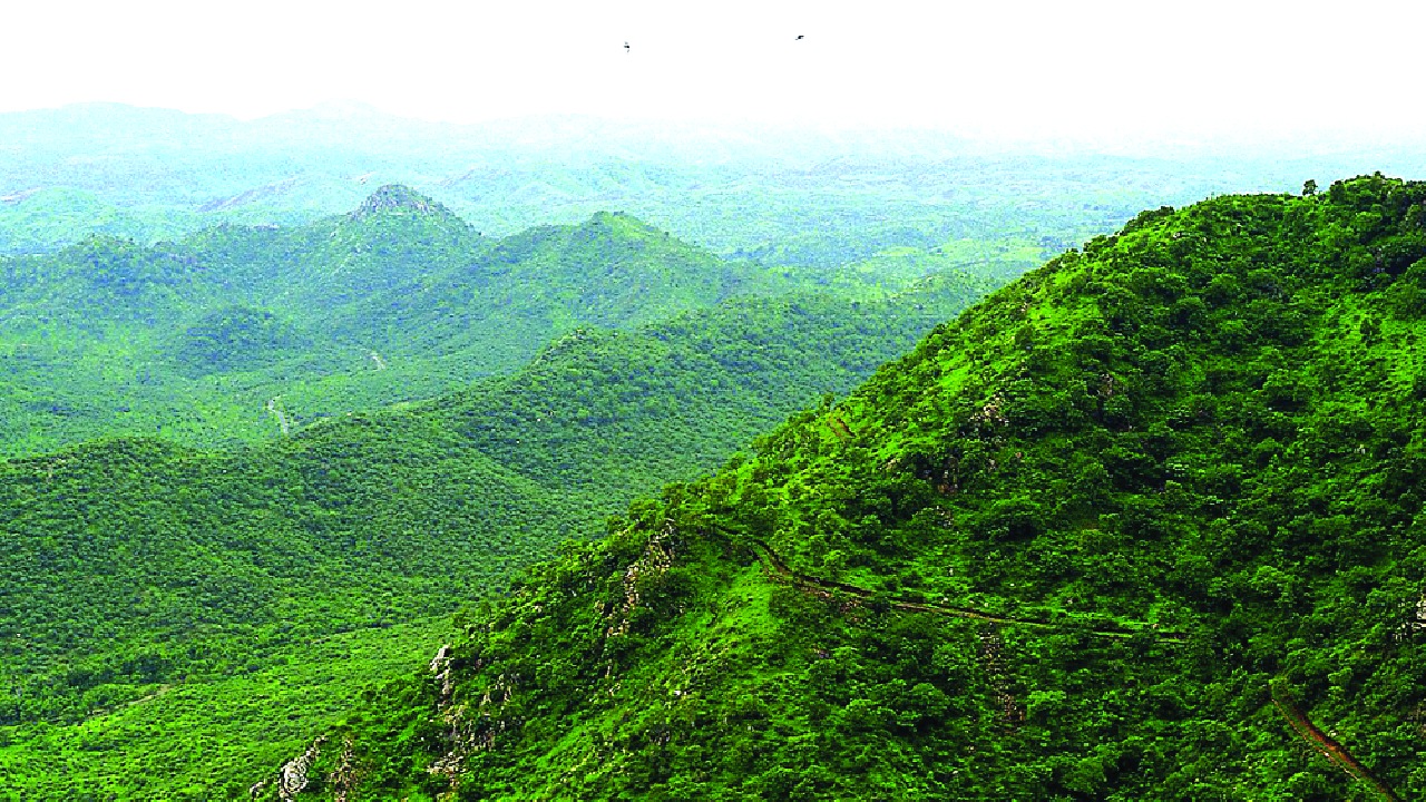
The Aravallis are not monolithic-neither geologically nor in their legal or revenue classification. These ancient fold mountains, with diverse Precambrian rocks, are a complex mosaic of land categories with distinct ownerships and regulatory frameworks. They include Gair Mumkin Pahar (uncultivable hill land), Bani or Beed (traditional village commons for grazing and community purposes), Gair Mumkin Rada or Khoh (ravines, gullies, and foothill landscapes), Mushtarka Malkan lands (privately owned commons), ‘deemed forests’ as interpreted by the Supreme Court in 1996, and forest lands administered by the Forest Department.
While the Forest Conservation Act, 1980 [Van (Sanrakshan Evam Samvardhan) Adhiniyam (VSSA), 1980] applies specifically to lands classified as ‘forest,’ a broader constellation of legal instruments governs land use across the Aravalli landscape. In certain regions, land use is regulated by the Aravalli Notification of 1992 issued under the Environment (Protection) Act, 1986, imposing restrictions on activities that damage the fragile hill ecosystem. In some other parts, especially in the National Capital Region, the NCR Planning Board Act, 1985 has designated these landscapes as Natural Conservation Zones to safeguard the ecological and hydrological functions of the Aravallis. The Central Ground Water Authority (CGWA) notifications, focusing on sub-surface hydrological connectivity in all areas, regulate activities affecting groundwater extraction and recharge. Projects such as mining operations or large townships exceeding specified thresholds are subject to mandatory Environmental Impact Assessments, further embedding environmental scrutiny within the regulatory framework.
Despite the existing regulatory systems, commercial interests driven by short-term gains have often overridden ecological considerations in the Aravallis in clear violation of the precautionary principle articulated by the Supreme Court in MC Mehta v Union of India. The Court held that ‘where there are threats of serious or irreversible damage, lack of full scientific certainty shall not be used as a reason for postponing cost-effective measures to prevent environmental degradation.’ The Aravallis have suffered considerable destruction also through the ‘salami-slicing’ of projects into smaller parcels to evade EIA thresholds, the consideration of Gair Mumkin Pahar lands as readily available for mining, and piecemeal approvals damaging the Aravallis’ ecological integrity. The Aravallis are suffering the tragedy of ‘death by a thousand cuts.’
Sensitivity towards natural ecosystems classified as forest is highest. In contrast, the value of ‘non-forest’ areas-particularly within xerophytic regions such as the Aravallis-is routinely undermined, although they provide critical ecosystem services towards desertification buffering and watershed integrity supporting millions of people. Dilution of overall environmental protection by altering the legal definition of lands-often justified in the name of reducing the ‘costs of business’ and improving ‘ease of doing business’-is a disturbing trend. Amendments that narrowed the scope of the VSSA, 1980 by exempting certain categories of forest land, and the attempt to redefine the Aravallis using an arbitrary 100-metre height criterion are some cases in point.
Considering the above background, any High-Powered Expert Committee (HPEC) would have a high-stakes scientific and legal mandate before it. Its foremost task would be to change the perception of decision-makers towards the Aravallis-from a narrow height-based, reductionist interpretation to an understanding of them as a contiguous, ancient mountain system that serves as the ecological spine of north-west India and extends across state boundaries. Achieving this shift will require the active participation of domain experts alongside administrators, so that the Aravallis are defined by ecological realities rather than bureaucratic
expediency.
The previous definition with a height threshold as the parameter ignored the importance of recognising all hills, ridges, saddles, and outcrops as parts of a unified ecological range and thereby created ecological islands, regulatory blind spots, fragmented wildlife corridors, and fractured desertification barriers. A decisive shift towards a functional approach is essential-one that produces a map-verifiable definition incorporating lower ridges and intervening saddles that contribute to groundwater recharge, biodiversity conservation, and climatic stability. Equally important is the inclusion of already mined, degraded, and potentially restorable areas within the regulatory ambit. This is particularly necessary because smaller outcrops and fragmented hillocks-rendered ‘legally invisible’ by the earlier definition-continue to play a vital role in maintaining the ecological integrity of the Aravallis, including the flow of essential ecosystem services.
Notably, the Forest Survey of India’s 2010 criteria, which emphasised slope, geomorphology, and canopy density, recognised the Aravallis as a structurally contiguous fold mountain system. A functional approach would ensure that gaps between hills are not misclassified as ‘non-hills’ but are recognised as structural basins, or saddles, that are part of the same geological and ecological entity. The entire range would therefore need to be mapped using high-resolution Digital Elevation Models (DEM). Such mapping would allow a realistic determination of the Aravalli ecosystem boundary delineated not merely on the basis of surface features and topography, but by accounting for sub-surface geological connectivity also, which is critical for sustaining groundwater recharge across the broader provision shed.
Given the limited effectiveness of the enforcement of existing legal instruments in the region, the Aravallis require an overarching legislative framework. The land falling within the defined Aravalli ecosystem boundary-excluding private holdings-should be declared ‘Protected Forest’ and brought under the purview of the VSSA, 1980. The process of its subsequent notification as ‘Reserve Forest’ may be initiated later in a phased manner.
The overall implementation framework of the VSSA in vogue today, however, requires immediate and substantive improvement to ensure effective protection and conservation. The VSSA’s Advisory Committee must also have professionals from ecology, hydrology, geology, public health, and social sciences.
Currently, the Net Present Value (NPV) framework, along with compensatory afforestation, is employed to offset forest diversion. This framework needs improvement since it is trapped in a flawed commodification logic assuming that one-time monetary compensation can substitute for the permanent loss of primary forests. It relies on generic ‘eco-class’ that overlooks site-specific criticalities, excludes services such as pollination and micro-climate regulation, ignores intergenerational ecological debt, and fails to account for cultural and spiritual values embedded in landscapes. Even periodic revisions of NPV rates-such as the 2002 revision after fourteen years-largely address inflation rather than ecological reality, leading to chronic undervaluation of natural capital.
Monitoring of compensatory afforestation must move beyond the assessment of survival rates. An Ecological Restoration Success (ERS) framework that assesses an area’s transition into a functional ecosystem should consider parameters like soil health, hydrology, biodiversity, carbon sequestration, and climate resilience.
Project proposals in the Aravallis must undertake an honest accounting of costs and benefits, including negative externalities. The loss of agricultural productivity, rising public health costs, degraded air quality in surrounding regions including the NCR, intensification of the urban heat island effect, and disruption of deep-fracture aquifer recharge are often excluded from assessments, masking the true price of ecological degradation. A meaningful opportunity-cost analysis must ask a fundamental question: what would it cost the public exchequer to artificially replicate-indefinitely-the water recharge, desertification control, and air filtration services that the Aravallis currently provide free of charge?
A Unified Aravalli Management Authority covering the entire range should be constituted, and a cross-state ‘Natural Conservation Zone’ created under the NCR Planning Board Act. Managing the Aravallis as protected forests across political boundaries may be challenging without adequate field-level presence of the Forest Department. Involving local self-government institutions appears attractive, but the examples of mass-scale irregular management rights under the Forest Rights Act and the strength of entrenched interests exploiting the Aravallis cannot be ignored. The Supreme Court may invoke the doctrine of in loco parentis, but ultimately conserving the Aravallis and similar ecosystems is the constitutional mandate of the Government. Already under immense pressure, the Aravallis cannot survive a prolonged vacuum of protection.
The writers are former PCCFs, UP and Maharashtra; views are personal