Kalladi landslide driven by human activity, say experts
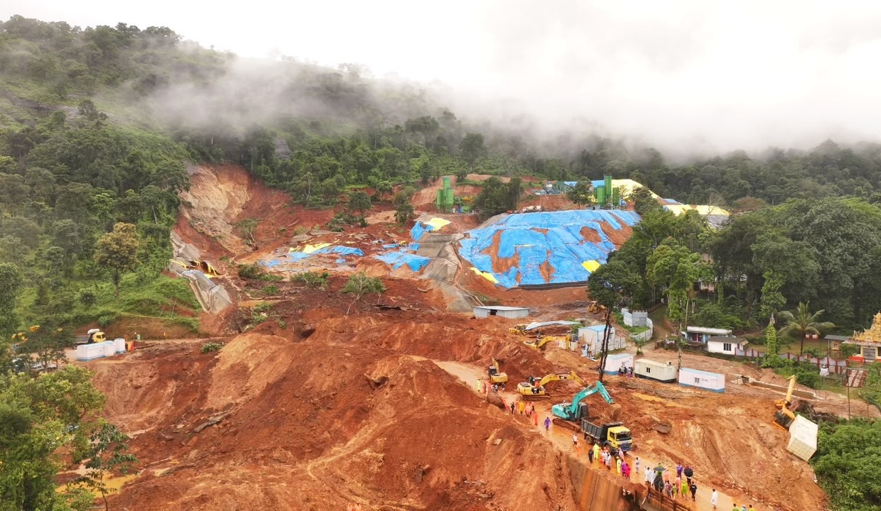
Thiruvananthapuram: Eye-catching landscapes, once lush and vibrant, reduced to rubble and mud - such sights were unfamiliar in Kerala before the 2018 floods. Wayanad, the northern district and a sought-after tourist destination, continues to bear the brunt of natural disasters since then.
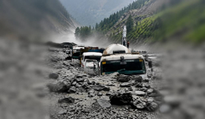
The latest was the landslide in Kalladi at the Meppadi panchayat, located at the Wayanad twin-tunnel project construction site. Eight people lost their lives in the landslide that occurred on July 7.
The landslide opened the door to a new debate on developmental projects in ecologically fragile regions. The important question being whether the disaster could have been avoided.
"The Western Ghats, that starts from the river Thapthi to Kanyakumari in Tamil Nadu, is one mountain range. We can find massive, hard and old igneous and metamorphic rocks on this mountain range. The soil that gets eroded in a landslide is on the surface, with a one- or two-meter thickness. At certain parts, the soil content would be high depending upon the geomorphological and geological scenario,” Dr Sajin Kumar K S, Assistant Professor, Department of Geology, University of Kerala, told The Pioneer. Geomorphology is the scientific study and classification of the Earth's topographic features.
"The Anakkampoyil-Kalladi road tunnel project is not just a tunnel crossing a mountain; it connects through different altitudinal ranges. The tunnel’s structure spans more than 500 meters in elevation from bottom to top. It starts from Kozhikode’s midland, or from the lower part of its highland; the thickness of soil in the region is one to two meters. When two meters of soil is removed, you get hard rock. Drilling and blasting the hard rock are not an issue. However, when it reaches Wayanad, the tunnel passes through a plateau or an extensive area of flat upland. Here, soil thickness is more, around five to ten meters. There will be issues here till the excavation reaches the main hard rocks. The landslide that occurred in Kalladi was during such an excavation. Once the excavation reaches the hard rock, the process will be smooth," he added.
According to Sajin Kumar, the stabilisation measure done after the soil removal was wrong and caused the landslide at Kalladi. The soil removed for the tunnel construction reportedly was piled on one side of the site. It was washed downhill by floodwaters, resulting in the landslide.
“They resorted to shotcreting after benching," he said. Shotcreting is a construction method where concrete paste is sprayed on excavated surfaces, whereas benching is a staged excavation method where a tunnel is carved out in horizontal layers. "This will only stabilise or hold the soil, but it lacks any foundation or footing. Instead of it, if a retaining wall and holes for the flow of extra water were constructed, perhaps the landslide could have been prevented,” he added.
The landslide occurred not in the excavated region, but in an upper area with a natural slope. The lower part was cut off, and hence the support base for the upper area changed, and it became vulnerable to being filled with water in a short time, which caused the landslide.
“The shotcreting was not sufficient to strengthen or mitigate the slope stability. Due to this, even a small amount of water slipping down would cause a landslide. This made the pouring of water easier into the region, making it vulnerable. The Konkan path is even more fragile than the proposed tunnel passing area. But we have even constructed a railway line on it. Landslides occur on the track during rains. In Wayanad too, landslides occur during the rains, and hence, the vigil should be doubled while doing construction activities. I think they have failed to understand the real geology and geomorphology of the area,” added Dr Kumar.
Dr Debi Prasanna Kanungo, a Chief Scientist from CSIR-CBRI, MoST, Government of India, who has been working in landslide disaster mitigation and management for more than 32 years, said that it was more of an anthropologically induced landslide.
“Twin tunnels were coming up, and the construction debris was dumped at the site. The lithotectonic set-up (refers to the architecture of a region's subsurface rock/material layers) and the structural/tectonic/hydrological forces that shaped them, the top debris layer and the weathered rocks beneath saturated with water, all these triggered the landslide with heavy precipitation on that day. Then, at a depth of 20–30 meters, there is some fresh rock. The topography, the slopes in the regions, were already in a marginally stable condition. It is a heavy rainfall area; water gets percolated down to the weathered rocks, and there is a lot of pore pressure generated,” he said.
He visited the 2024 Wayanad Debris Flow site and the 2019 landslide sites of Idukki District, both having a similar lithotectonic setup and behaviour. “When the debris was dumped, they were again loading the slope. When we generally try to mitigate a landslide, we have to look at whether we can unload the slope. In this case, they loaded the slope with more material. The other aspect is that the dumping site has to be protected so that it won't slide or flow. Heavy rainfall triggered the landslide in a marginally stable slope, which was heavily loaded. The dumped material was not compacted; it was loose material. Then it came as a debris flow due to heavy precipitation, making it an anthropologically induced landslide. We should be very careful when debris is dumped in hill areas. Also, there was no support in the dumped area,” the scientist further said.
He added that the Kalladi landslide was similar to the 2019 landslides in Idukki district. "With heavy rainfall, pore water pressure will surpass the marginally stable condition and will trigger the landslide with a cascading switch over to viscous debris flow, taking away everything on its travel path with high velocity and flow pressure," he said.