From Porvorim to Delhi-Mumbai, 5 corridors that could define India’s next decade of growth
The next infrastructure story is no longer about how many kilometres of road India builds. It is about what those kilometres unlock. A 5.15-km elevated corridor in Goa, a 1,386-km expressway linking Delhi and Mumbai, a 263-km highway connecting Bengaluru and Chennai, India’s longest sea bridge in Mumbai and a chain of industrial nodes stretching from Punjab to West Bengal may appear to have little in common. But together, they point to a significant move in India’s infrastructure strategy: connectivity is increasingly being designed as an economic multiplier, not merely as a transport solution.
The Porvorim elevated corridor on NH-66 is perhaps the most compact example of this transformation. The six-lane, 5.15-km project between Sangolda junction and the Majestic Hotel section was announced at an estimated cost of Rs 641.4 crore. Its significance extends beyond easing a notorious urban bottleneck. It sits on a strategic route connecting Goa’s urban centres with the northern part of the state and the wider Mopa airport-led growth geography.
That matters for a state where tourism, hospitality, services and mobility are tightly linked. The ruling establishment at Centre has itself described the Manohar International Airport as infrastructure supporting Goa’s growing tourism industry. A separate seven-km access-controlled road connecting the airport to Dhargal was completed at a cost of Rs 1,183 crore, with the government saying it would support tourism and multimodal connectivity while reducing logistics costs.
Put simply, Porvorim is not just about traffic. It is about keeping an economic artery moving.
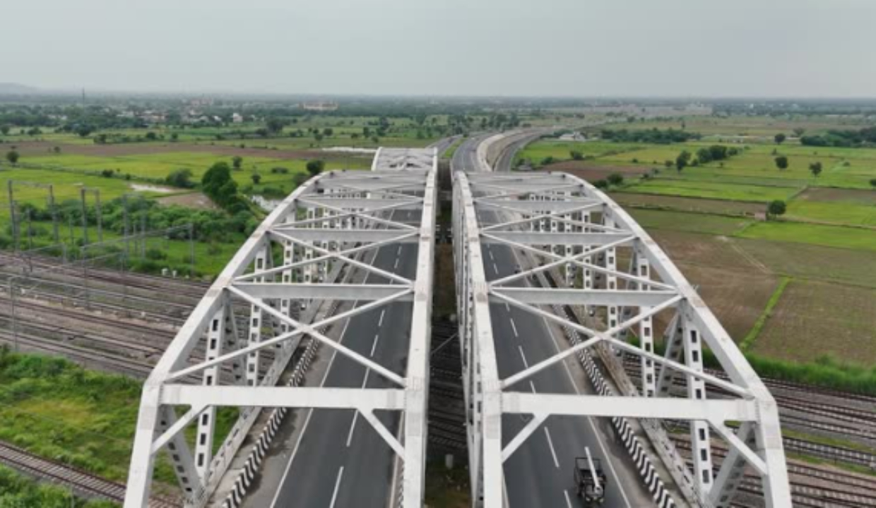
Heading to the North, the scale becomes very different. Another example of this type of concept can be seen through the Delhi-Mumbai Expressway which can be called the logistics version of it. According to the government, the route is 1,386 km long and passes through Delhi, Haryana, Rajasthan, Madhya Pradesh, Gujarat, and Maharashtra. According to the government data, high-speed corridors under Bharatmala will be able to cut down the travelling time by 40-50% in some selected economic nodes.
In August, the section of the route of 9 km, out of which 8.5 km is an elevated highway, connecting DND to Jaitpur was inaugurated for trial usage to enhance the accessibility to the highway from Delhi.
If Delhi-Mumbai is about compressing distance, Bengaluru-Chennai is about compressing the space between technology and manufacturing.
This 262-km greenfield expressway connects Karnataka, Andhra Pradesh and Tamil Nadu. The project, estimated to cost more than Rs 14,870 crore, is expected to bring down travel time between the two metropolises by two to three hours. However, its significance goes beyond in terms of its industrial geography. As per the industrial corridor strategy of the Centre, Tumakuru, Ponneri and Krishnapatnam form important nodes on the Chennai-Bengaluru Industrial Corridor.
However, what the project has revealed is that when it comes to infrastructure-led growth, the strength of a corridor is determined by its weakest link package. While more than 90% of the expressway is complete, it is the 25.5-km Tamil Nadu stretch that holds the key.
Mumbai offers another model. The 21.8-km Atal Setu, with 16.5 km over the sea, has connected Mumbai more efficiently with Navi Mumbai and improved links towards Mumbai and Jawahalal Nehru ports. PIB puts its cost at more than Rs 17,840 crore.
Its economic impact is already visible beyond road travel. Connectivity around the Mumbai Trans Harbour Link has reshaped property valuations, with areas benefiting from faster access attracting greater residential and commercial interest.
Then comes the Amritsar-Kolkata Industrial Corridor, where the road is only one component of a much larger economic proposition. The corridor spans Punjab, Haryana, Uttarakhand, Uttar Pradesh, Bihar, Jharkhand and West Bengal. Recent government data puts the potential of six new manufacturing clusters under the corridor at more than Rs 67,000 crore in investment and over 4.6 lakh jobs.
That is the bigger story running through these five corridors: beneath the elevated roads, expressways, sea bridges and industrial links is a new economic geography taking shape — one in which connectivity is becoming the trigger for investment, the catalyst for jobs and the bridge between India’s emerging growth centres.
Porvorim tackles urban friction. Delhi-Mumbai tackles distance. Bengaluru-Chennai tackles industrial connectivity. Atal Setu tackles metropolitan geography. Amritsar-Kolkata tackles distributed manufacturing.
India’s infrastructure push is therefore entering a more consequential phase. The value of a highway will increasingly be judged by the factories it attracts, the tourists it moves, the ports it feeds, the logistics costs it removes and the new economic centres it makes viable.
The question for the next decade is not simply how fast India can build roads. It is whether India can make every strategic corridor generate more economic activity than the road itself carries.
The Writer is a Consultant in Rural Advocacy.