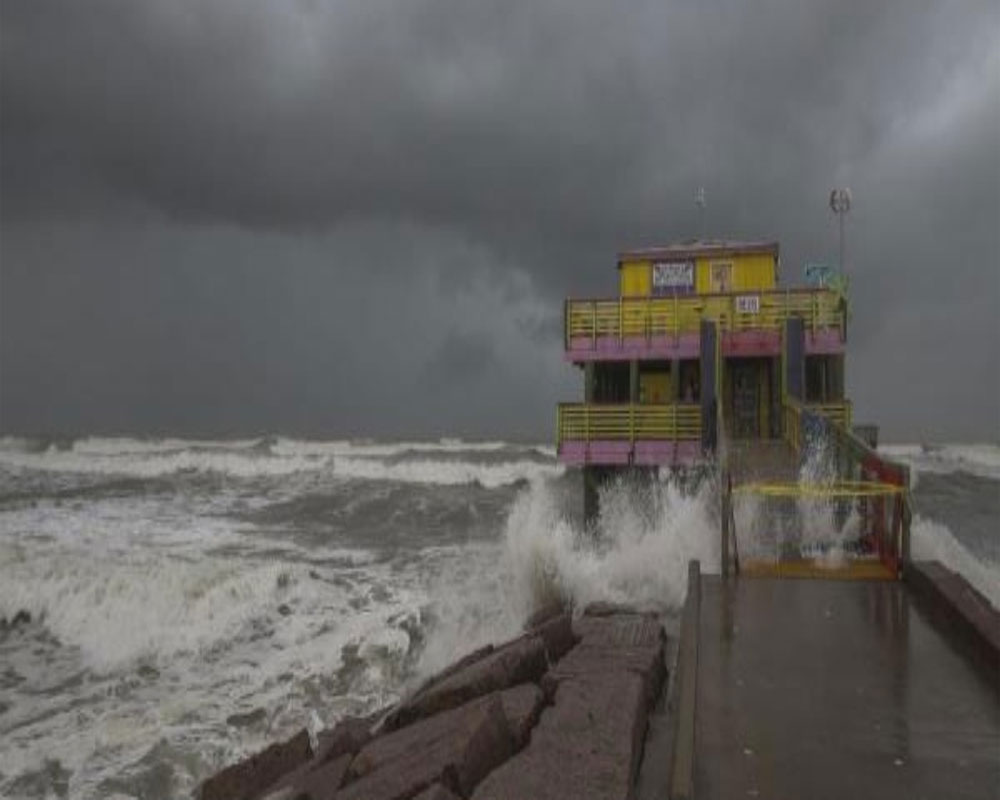
Laura has strengthened into an "extremely dangerous" Category 4 hurricane with a maximum wind speed of 140 miles per hour as it heads for a catastrophic landfall near the Texas and Louisiana border, US authorities have said.
Destructive storm surge and damaging winds will affect areas near the site of landfall. Hurricane Laura is also an inland flood risk as far north and east as Arkansas and the Ohio and Tennessee valleys. Isolated tornadoes are also expected from Laura.
"As of right now, it looks like Houston will be spared from the major impacts and power outages. It could experience gusty, possibly tropical storm force, winds and stormy weather at times from the rainbands. Our eastern cities including Winnie, Liberty, and Livingston could still experience damaging winds as the hurricane moves north onto land late tonight into tomorrow morning , according to the National Hurricane Center advisory.
In Texas, around 4,00,000 people in coastal areas of Galveston, Beaumont and Port Arthur have been placed under mandatory evacuation orders. Texas Governor Greg Abbott told reporters Wednesday that those in Laura's path should leave if they haven't already done so.
"The power of Hurricane Laura is unprecedented, and Texans must take action now to get out of harm's way and protect themselves," Abbott said. "The State of Texas is prepared to respond to the storm, and we are working alongside federal and local officials to keep Texans safe."
The COVID-19 pandemic is complicating efforts to shelter evacuees safely. They are being directed to hotels instead of typically crowded shelters.
Despite warnings, some residents said they are going to stay behind and are taking measures to prepare their homes, using storm shutters and generators. Some were boarding their homes with plyboard all day.
The mayor of Lake Charles said he suspects the coronavirus pandemic and economic hardship are leading many people to take pause. People staying behind will likely have to wait hours for first responders to reach them.
"As soon as winds get above 40 mph, it is just absolutely unsafe to have vehicles out on the road," Hunter said. "So if people are staying, there is going to be an extended period of time, at least four to six hours, where public safety, law enforcement will not be able to respond to you."
Louisiana Governor John Bel Edwards said in a news conference, "The storm surge flooding is starting now in Louisiana, well ahead of the storm. It will just get worse over the next day or so."
More than 2,00,000 people in the Calcasieu and Cameron parishes of southwestern Louisiana were placed under a mandatory evacuation order. "If you're in those low-lying areas, if your local officials have told you that there's an evacuation in place, whether it's mandatory or voluntary, we need you evacuating now," Edwards said.
Laura's storm surge is expected to reach levels not seen in Louisiana since Hurricane Audrey in 1957, he said.
According to the National Hurricane Center, Laura is an "extremely dangerous" Category 4 hurricane, now with maximum sustained winds of near 150 mph - just 12 mph short of the Category 5 classification. Forecasters say the storm could strengthen before it reaches the coast.
The Center said storm surge - the rise in seawater caused by a storm - and tropical storm-force winds will arrive well in advance of the storm's center, and that "all preparations to protect life and property should be rushed to completion in the next few hours."
"Keep in mind that a hurricane isn't just a point. Impacts will extend far from where the center eventually moves inland , experts added.
As of late Wednesday evening, water is rising along beaches and roads in parts of southern Louisiana and Texas, and winds across the region are picking up speed. The National Hurricane Center said on Wednesday afternoon that if people delay evacuating, the roads could already be flooded.
Laura is expected to weaken rapidly after it makes landfall Wednesday night into Thursday morning, but the projected storm surge could still cause the most life-threatening damage, the hurricane center said.
If the peak surge occurs during high tide, the water along Johnson Bayou to Rockefeller Wildlife Refuge on the Louisiana coast could rise between 15 and 20 feet. Other nearby areas could see storm surge as high as 15 feet.


