A faltering monsoon, a nervous nation and an anxious sowing season
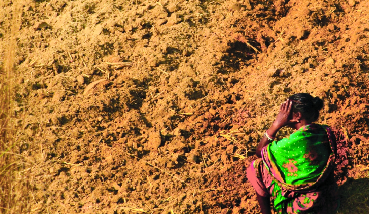
The sowing of kharif crops has fallen by 23 per cent compared to last year, according to the latest figures released by the Ministry of Agriculture and Farmers’ Welfare, as India reels under its third-driest June in 100 years. The India Meteorological Department (IMD) data shows a nationwide rainfall deficit of 40 per cent. The weather office in its forecast has predicted below normal rainfall in July as El Nino conditions continue to strengthen over the equatorial Pacific Ocean. Sowing of kharif crops normally begins with the onset of the southwest monsoon from June. The shortfall is leaving farmers, planners and city administrators on edge.
According to the latest figures released by the agriculture ministry, the total area under kharif crops stood at 182.72 lakh hectares as of June 25, compared to 236.46 lakh hectares during the same period last year. Not only rice but also pulses, oilseeds, coarse cereals and cotton have seen lower sowing than the year-ago period.
According to the latest data, paddy acreage — the main kharif crop -- was down 25.17 per cent at 25.75 lakh hectares as on June 25, against 34.41 lakh hectares last year. Pulses sowing lagged by 30.47 per cent at 14.92 lakh hectares versus 21.46 lakh hectares, while oilseeds area plunged 53.33 per cent to 16.99 lakh hectares from 36.41 lakh hectares. Among pulses, tur, arhar sowing stood at 3.56 lakh hectares against 8.45 lakh hectares.
In oilseeds, groundnut area fell to 8.87 lakh hectares from 15.29 lakh hectares, and soybean to 6.92 lakh hectares from 19.97 lakh hectares. Coarse cereals acreage declined to 31.84 lakh hectare from 36.07 lakh hectare. Cotton sowing dropped 34.61 per cent to 29.66 lakh hectares from 45.36 lakh hectares in the said period.
Reservoir levels also remain a concern. The total live storage in 166 important reservoirs monitored by the Central Water Commission (CWC) as on June 25 stood at 48.405 billion cubic metres (BCM), or 26.37 per cent of full reservoir level (FRL) capacity.
The average rainfall recorded across the country in June so far stands at 92.2mm, against a normal of 157.7mm. Even with a good spell of rain expected on the month’s last day, June is likely to close at around 100mm overall. In the past 100 years, between 1927 and 2026, only two years have recorded lower June rainfall than this — 2009 (87.5mm) and 2014 (92.1mm), both within the last two decades.
Northwest India has recorded a substantial rainfall deficit of 31 per cent, receiving 53.7 mm against the seasonal normal of 78.1 mm. The delayed arrival of the monsoon has kept Delhi, Haryana, Punjab and western Rajasthan under persistent heatwave conditions for much of June. Meanwhile, the southern peninsula is experiencing a rainfall deficit of 27 per cent, with 117.4 mm recorded against a normal of 161 mm. Although parts of Kerala and the west coast received periodic heavy showers, rainfall remained uneven across several southern States. The situation in East and Northeast India was no different as the region recorded 197.5 mm of rainfall against a normal 328.4 mm, a dip of 40 per cent.
At the State level, the rainfall distribution remained highly uneven. Among the worst-affected states were Jharkhand, which recorded a 59 per cent deficit, Chhattisgarh at 65 per cent below normal, Gujarat with an 82 per cent deficit, and Dadra and Nagar Haveli and Daman and Diu, which witnessed an alarming 84 per cent rainfall shortfall. Several northern States also remained rain-deficient, including Uttar Pradesh (50 per cent), Bihar (47 per cent), Punjab (47 per cent), Delhi (49 per cent), Haryana (29 per cent), Madhya Pradesh (33 per cent), Maharashtra (47 per cent), Tamil Nadu (32 per cent) and Kerala (34 per cent).
Satellite imagery has captured the formation of a nearly 1,500-km-long monsoon trough stretching from the northern Bay of Bengal to Jammu and Kashmir, a crucial weather feature that could pave the way for widespread rainfall over the region in the coming days. The satellite image from INSAT-3DS shows a broad swath of dense cloud cover extending from eastern India into the Himalayan belt, highlighting the strengthening monsoon circulation after nearly three weeks of sluggish progress. The trough acts as the backbone of the southwest monsoon.