US map depicts PoK, Aksai Chin as part of India
The US has unequivocally indicated its growing ties with India when it released a map showing the entire Jammu and Kashmir region, including Pakistan-occupied Kashmir (POK) and Aksai Chin, as part of India. The United States Trade Representative (USTR) also depicted Aksai Chin as Indian Territory.
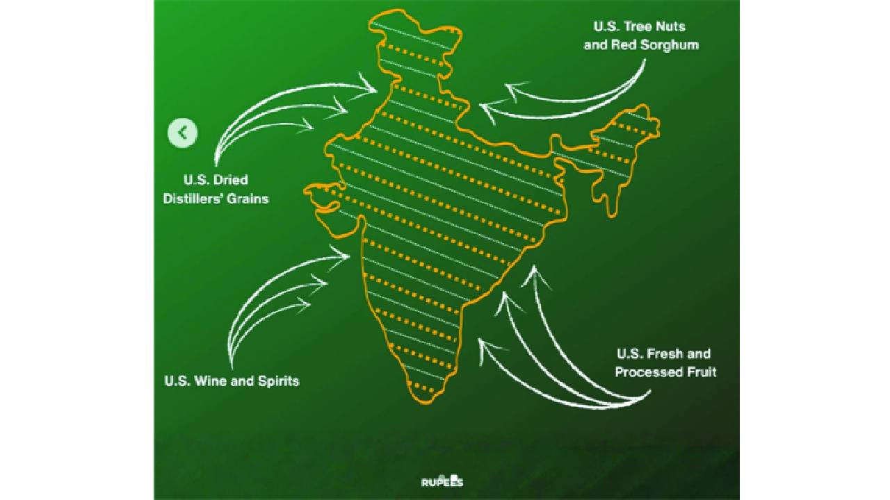
Both of these have direct implications for Pakistan and China, as the former always raises the Kashmir issue at various international forums, and the latter claims Aksai Chin as its territory. The map appeared in a graphic linked to the new India-US tariff deal, highlighting trade concessions and adjustments between the two countries.
The visual depiction of India’s political boundaries, with the northern Union Territory of Jammu and Kashmir fully included, is being viewed as a clear signal of Washington’s position on the territorial issue. However, the cartographic details reflect alignment with India’s official map, underscoring the depth of India-US strategic ties.
The development comes at a time when Pakistan has been attempting to intensify diplomatic engagement with the US. This comes across as a possible setback for Islamabad. Prime Minister Shehbaz Sharif and Army Chief Asim Munir have made multiple trips to Washington to lobby hard in the US corridors of power.
However, the latest map released by the Trump administration stumps Pakistan’s claims. The timing is also crucial, as India and the US resets its ties under Trump. Moreover, Trump also sought to re-hyphenate India and Pakistan, reversing the de-hyphenation policy started by the George W Bush administration and followed by subsequent presidents. Though the USTR did not comment on the map, it comes as an embarrassment for Pakistan, which claims PoK. This instance is different as the map was released by a formal unit of the US Government in connection with a bilateral agreement. While Washington has not issued a separate clarification or explanation, the absence of any qualifying disclaimer has added to the map’s significance.
Moreover, the map also shows the disputed Aksai Chin region, located in the northeastern part of Ladakh, as part of India. China has always laid claim to the disputed land, ignoring India’s objections.
The Ministry of External Affairs has also objected in the past to depictions that show the region as disputed or divided, particularly after constitutional changes affecting the former state in 2019.
In 2020, Pakistan approved a new political map claiming Jammu and Kashmir and parts of Ladakh, as well as Junagadh, Manavadar and Sir Creek in Gujarat, as its territory. India had dismissed the move, calling it “an exercise in political absurdity” and rejecting what it termed untenable claims over Indian Territory.
Leave a Comment
Comments (2)
For Modi everything is possible. The Almighty helps them whose intentions are for the betterment of whole humanity.
For Modi everything is possible. The Almighty helps them whose intentions are for the betterment of whole humanity.