The formation of a tropical cyclone itself is going to be more readily triggered when there is availability of very warm conditions at the ocean surface and when the vertical temperature gradient through the atmosphere is strong
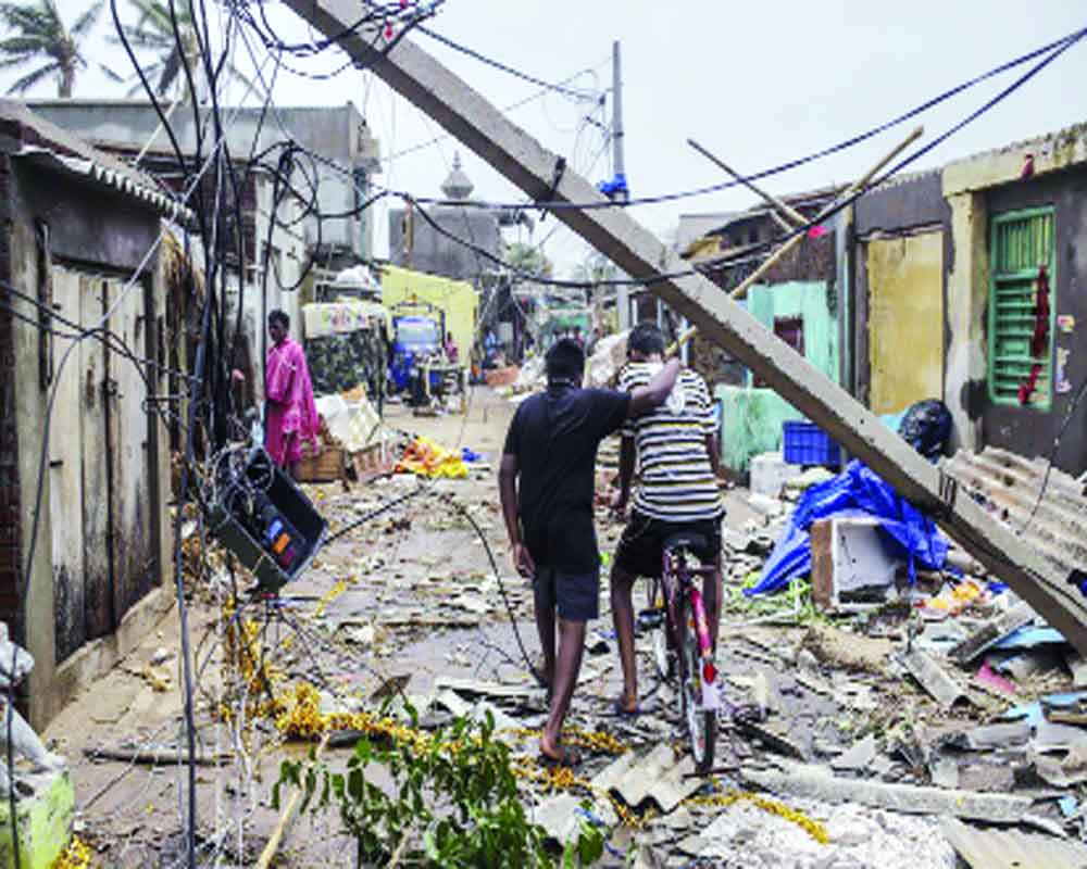
Fani wreaked unprecedented havoc in Odisha as it was the second such severe cyclone in the last hundred years to have formed in the Bay of Bengal. In spite of these harsh credentials, it could not exact much human casualties. This storm has had an interesting life since it first formed as a low-pressure area over the equatorial Indian Ocean and southeast Bay of Bengal on April 25, 2019. In short, it has been highly unpredictable for forecasters to pin it down, especially with respect to its track and speed.
After forming and intensifying into a depression, Fani moved towards Sri Lanka and threatened to make landfall somewhere on the coast of Tamil Nadu, according to forecasters. But then, it changed its direction and also decreased its pace to stay in the Bay of Bengal for more than eight days, all the while becoming more intense and ending up becoming an extremely severe cyclonic storm. Such cyclones sniff out warm waters on the sea surface and progressively become more intense. This is where climate change comes in. Scientists and weather experts now firmly believe that enough studies have proven that warmer sea surfaces due to climate change make cyclones not only frequent but also intense in nature.
Towards the end of its journey through the Bay of Bengal, Fani changed its character again. At first, the India Meteorological Department (IMD) predicted that Fani on landfall would carry ferocious winds with speed ranging from 175-185 kilometres per hour (kmph). With a final wind speed of more than 200 kmph, it battered the coastal areas of Odisha. Ferocious winds not only claimed 34 lives but have left a trail of destruction with life almost coming to a standstill. In spite of rising sea surface temperatures contributing to the severity of cyclones, mankind has been unable to rein in global warming and consequently, climate change. The coastal areas, which can directly contribute towards lowering sea surface temperatures, are still engaged in activities that are detrimental to a healthy environment.
In the immediate future, climate change is likely to affect tropical cyclone behaviour even more intensely in two ways. First, the formation of a tropical cyclone itself is going to be more readily triggered when there is availability of very warm conditions at the ocean surface and when the vertical temperature gradient through the atmosphere is strong. As the climate continues to warm up, the difference between the temperature near the surface of the Earth and the temperature higher up in the atmosphere is likely to decrease. Given a rise in greenhouse gas emissions and spiralling global warming, these conditions at the ocean level are going from bad to worse.
In addition to this, an increase in temperature of the surface ocean also affects the intensity of cyclones along with changes in upper atmosphere conditions both in terms of maximum wind speeds and in the intensity of rainfall that occurs in association with the cyclone. This because the storms draw energy from the surface waters of the ocean and as more heat/energy is stored in these upper waters, cyclones have a larger source of energy to draw from.
The interconnected nature of climate change with extreme natural events, especially cyclones, needs to be understood in detail. The erstwhile nature of cyclones during the 70s and even the 80s used to be frequent but they came along with a certain degree of predictable intensity with them. But of late, as ocean temperatures warm up rapidly, thanks to climate change, this predictability has been the first casualty. In fact, it is being estimated by the scientific community that in the coming decades, the frequency of cyclones may come down but this can hardly be considered as a harbinger of good news because the cyclones, as and when they occur, will be so fierce and devastating that recovery will take years for affected regions.
The human race is quick at adoption and that is what we are doing. Take the case of Odisha, which evacuated its people and minimised the loss of life really well. This is one State which has set a template. The way Odisha tackled the natural disaster may also mean that human race has now finally chosen to fall in line and adapt to harsh climate change conditions rather than fight with the same and reverse it. This realisation should not just be for India but for the global community as well.
Rightly did Odisha receive acclaim from the UN for for enabling successful evacuation of its people. But it would have been even greater if India had come to global attention for its measures to tackle global warming, especially sea surface temperatures, that eventually contribute to either reducing the frequency of cyclones or at least bringing down their intensity.
All is still not lost as far as the threat of cyclones is concerned. India can still make a difference by showing that coastal communities and cities can tackle global warming and keep their sea temperatures down. The world is bristling with technology that can change the course of how a cyclone can and will behave. Will our leadership and Government make a difference this time? Guess we may have to wait and watch the next cyclone.
(The writer is an environmental journalist)


