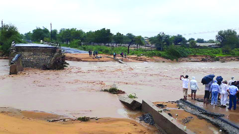
In a little over three decades — between 1978 and 2011 — a whopping 10 million additional hectares of land became flood-prone area in India.
While 40 million hectares of land were “prone to floods” till 1978 as per the Rashtriya Barh Ayog (RBA) that studied figures since 1953, the 12th Plan working group on flood and management subsequently increased the area to 49.815 million hectares in 2011.
As per the RBA report, 7.33 million hectares in Uttar Pradesh and 4.26 million hectares of land in Bihar are prone to flood. “Similarly, 3.70 million hectares of land in Rajasthan, 3.26 million hectares of land in Sikkim, 3.15 million hectares in Assam, 2.70 million hectares in West Bengal and 2.35 million hectares in Haryana are prone to flood,” the report said.
And the addition of flood-prone areas, as per the 12th Plan working group, has been spread across several States like Bihar, Haryana, West Bengal, Uttar Pradesh, Rajasthan and Assam among others.
While studies have pointed to construction of dams in Indo-Gangetic rivers to be mitigating the hazards in recent decades, the Water Resources Ministry has informed Parliament that the main reasons for floods are high intensity rainfall in short duration, poor or inadequate drainage capacity, unplanned reservoir regulation and failure of flood control structures. “Intense rain during the monsoon season causes rivers like Brahmaputra, Ganga and Yamuna to swell their banks, which, in turn, flood the adjacent areas,” the Ministry maintained.
A separate study carried out by the National Remote Sensing Centre of ISRO found that 15 districts of Assam, 10 each of Bihar and Uttar Pradesh, nine of Odisha and six of West Bengal get submerged by floods for varying percentage.
For its part, the National Disaster Management Authority’s (NDMA) ‘flood vulnerability index’ lists Punjab and Haryana as the States most vulnerable to floods. Punjab is followed by West Bengal, Bihar, UP, Andhra Pradesh, Haryana, Kerala, Assam, Gujarat and Odisha.
According to the Met Department, the country received 718.7 mm rainfall against the normal of 768.9 mm till September 8, this year.
As many as 110 districts have recorded excess rainfall during this year’s monsoon. Despite that the rain deficit stood at 7 per cent this year. In 2018, as many as 500 people have been killed and over 10 lakh displaced in Kerala due to floods and landslides in the State.
The impact of the floods in Kerala is yet to be completely assessed, though the Government estimates that rebuilding would require about Rs 30,000 crore.
Officials said the NDMA’s study is based on parameters such as areas actually flooded during 1950 to 2016, areas vulnerable to flood and metropolitan and large cities that fall in flood-prone areas.
On a scale of 10, Punjab has been assessed as facing the highest flood hazard risk of 6.67, followed by West Bengal 6.43, Bihar 6, UP 4.76, Andhra Pradesh 4.49, Haryana 4.12, Kerala 3.88, Assam 3.84, Gujarat 3.38 and Odisha 2.73.
As per the Home Ministry data, as many as 1,400 people have died due to rain, landslides and floods in 10 States so far in the monsoon season. As many as 254 people died in Uttar Pradesh while West Bengal witnessed the death of 210 people due to floods. The toll in Maharashtra was 139 while it was 52, 50, 37, 29 and 11 in Gujarat, Assam, Uttarakhand, Odisha and Nagaland respectively.


