
China issues Level-IV alert as barrier lake threatens fresh flooding at Tibet-Nepal border
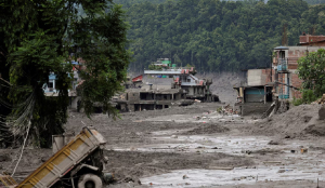
China has sounded a Level-IV alert following devastating flash floods at the Tibet-Nepal border, warning that a newly formed barrier lake at the confluence of two rivers faces a high risk of breaching and flooding downstream areas.
China's Ministry of Water Resources issued the emergency alert for the Tibet Autonomous Region on Thursday night, warning of the threat from the barrier lake, which formed near the confluence of the Chhochen Khola and Purepu Tsangpo rivers. These rivers originate in Tibet and flow into Nepal as part of the Bhote Koshi river system. China's four-level disaster response system runs from Level-I, the most severe, to Level-IV, the least.
The lake had accumulated an estimated two million cubic metres of water as of Thursday morning, state-run Xinhua reported. Forecasts suggest inflows could reach about three million cubic metres over the next three days amid continued rainfall, raising the risk of a breach that could send floodwaters downstream — potentially causing further damage at Gyirong Port on the China-Nepal border and beyond. The ministry has instructed local authorities to closely monitor the lake and rainfall, strengthen forecasting and risk assessment, and identify people in potentially affected downstream areas.
China has deployed satellites and drones to support rescue efforts. The China National Space Administration said it had carried out emergency imaging of the affected area and retrieved historical imagery, delivering five pre-disaster and 10 post-disaster images to emergency response and disaster relief departments. China has also sent its Wing Loong unmanned aerial vehicle, fitted with high-definition cameras, for reconnaissance, while rescue teams are using smaller drones on the ground.
The high-definition footage is being used to build 3D models of the flood-hit area, helping the rescue command centre identify priority search zones, Xinhua reported. Rescuers are also using drones' thermal imaging equipment to detect human heat signatures in vegetated and mud-covered terrain, in an effort to locate missing people.
China has reported 558 people missing, including many foreign tourists, after flash floods struck Gyirong Port in Gyirong County on August 26. Rescue work has been complicated by the barrier lake, which officials fear could cause a secondary disaster.
An eight-member advance team from state-owned engineering and rescue firm China Anneng arrived in Gyirong County on Thursday with communications and detection equipment to gather data and address the upstream blockage — a top priority before debris accumulated roughly three kilometres upstream of the port can be safely cleared, rescue personnel said. Firefighters have used drones to mark points around the lake's perimeter to calculate its surface area; footage showed the water level had risen since Wednesday night.
Chinese Premier Li Qiang visited the disaster area on Thursday with senior officials to assess the damage and will oversee rescue and relief operations. A directing group from the People's Liberation Army's Western Theatre Command, which oversees the India-China border in Tibet, was also dispatched to coordinate joint military rescue operations in Gyirong County.