
- HOME
- INDIA
- WORLD
- BUSINESS
- STATES
- LAW & JUSTICE
- ENTERTAINMENT
- SPORTS
- VIEWPOINT
- LIFESTYLE
- TECH
India has formally recorded 28 places and landforms in Ladakh on Survey of India maps, a step the Government says is meant to fix their names in official records and make them easier for the public to recognise.
The Ministry of Home Affairs said on Friday that the list was prepared in coordination with the Union Territory administration. The places will now appear under standardised names on the official map of Ladakh. The exercise follows a similar move in August, when the Union Government standardised the names of 27 places and features in Arunachal Pradesh.
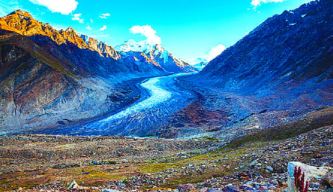
The Ladakh list mixes peaks, passes, glaciers, valleys, rivers and other features. Among the peaks are Zorawar Peak, Kanishka Peak, Atisha Giri, Martand Giri, Rinchen Zangpo, Sakyasri Giri, Marpa Lotsava Ri, Milarepa Kangri, Shiva Ri and Maheshvara Ri. Mountains named in the exercise include Karun Pir, Drak Karpo and Jolmori. Passes include Chapchingal Pass and Shachmirk Pass. Glaciers on the list are Parpik and Skamri, along with Shkorga Valley.
Other features identified are Brangsa, Kuksel, Dehra Compass, Gogra, Kumarayana Point, Panglung and Shamal Lungpa, as well as Guru Rinpoche Lake, the Yangpa River and hot spring.
The timing is significant because Beijing has, for years, issued Chinese names for locations inside territory India regards as its own.
Since 2017, it has released successive lists, starting with six places, then 15 in 2021, further batches in 2023 and 2024, and another 23 in April 2026.
Commentators have called the practice cartographic pressure, arguing that repeated renaming is meant to bolster territorial claims and shape how disputed areas appear on maps. China refers to Arunachal Pradesh as Zangnan”, or southern Tibet, and has announced fresh Chinese names for places there more than once. Tibet itself was taken over by Chinese forces in 1950, sending large numbers of Tibetans into India and Nepal.
New Delhi has rejected those moves, saying a change of name does not alter the status of Indian territory or India’s sovereignty over it. The August Arunachal list included locations such as Thag La, Dzo La, Riza La, Pukur La and Jaswant Garh. The Ladakh mapping extends that approach to another stretch of the frontier where India and China remain in dispute.